
Pärnu County: Difference between revisions
m →Municipalities: Numbers format fixed per Manual of Style |
|||
| Line 51: | Line 51: | ||
The county is subdivided into [[Municipalities of Estonia|municipalities]]. There is one urban municipality (Estonian: ''linnad'' – towns) and six rural municipalities (Estonian: ''vallad'' – parishes) in Pärnu County. |
The county is subdivided into [[Municipalities of Estonia|municipalities]]. There is one urban municipality (Estonian: ''linnad'' – towns) and six rural municipalities (Estonian: ''vallad'' – parishes) in Pärnu County. |
||
{| class="wikitable sortable" |
|||
===Urban municipalities=== |
|||
|- |
|||
*[[Pärnu]] |
|||
! Rank !! Municipality !! Type !! Population<br/>(2018)<ref name=population>{{cite web|title=Elanike demograafiline jaotus maakonniti|url=http://f.ell.ee/failid/kodukas/rahvastik/2018-01-01_rahvastik_netti_.htm|publisher=Kohaliku omavalitsuse portaal|accessdate=2 April 2018}}</ref> !! Area<br/>km<sup>2</sup><ref name=population/> !! Density<ref name=population/> |
|||
|- |
|||
|1 || [[Häädemeeste Parish]] || Rural || 4,985 || 494 || 10.1 |
|||
|- |
|||
|2 || [[Kihnu Parish]] || Rural || 702 || 17 || 41.3 |
|||
|- |
|||
|3 || [[Lääneranna Parish]] || Rural || 5,494 || 1,352 || 4.1 |
|||
|- |
|||
| ⚫ | |||
|- |
|||
|5 || [[Pärnu]] || Urban || 51,649 || 855 || 60.4 |
|||
|- |
|||
|6 || [[Saarde Parish]] || Rural || 4,722 || 1,065 || 4.4 |
|||
|- |
|||
|7 || [[Tori Parish]] || Rural || 11,694 || 611 || 19.1 |
|||
|} |
|||
===Rural municipalities=== |
|||
[[Image:Parnu municipalities.png|thumb|right|400px|Municipalities of Pärnu County]] |
[[Image:Parnu municipalities.png|thumb|right|400px|Municipalities of Pärnu County]] |
||
*[[Häädemeeste Parish]] |
|||
*[[Kihnu Parish]] |
|||
*[[Lääneranna Parish]] |
|||
| ⚫ | |||
*[[Saarde Parish]] (''includes the town of [[Kilingi-Nõmme]]'') |
|||
*[[Tori Parish]] |
|||
== Geography == |
== Geography == |
||
Revision as of 17:32, 2 April 2018
Pärnu County | |
|---|---|
 | |
 Coat of arms | |
 | |
| Country | Estonia |
| Capital | Pärnu |
| Government | |
| • Governor | Andres Metsoja |
| Area | |
| • Total | 4,806.68 km2 (1,855.87 sq mi) |
| Population (Jan 2017[1]) | |
| • Total | 84,462 |
| • Rank | 4th |
| • Density | 18/km2 (46/sq mi) |
| Ethnicity | |
| • Estonians | 89.1% |
| • Russians | 7.6% |
| • other | 3.3% |
| ISO 3166 code | EE-67 |
| Vehicle registration | F |
| Website | www |

Pärnu County (Estonian: Pärnu maakond), or Pärnumaa (German: Kreis Pernau), is one of 15 counties of Estonia. It is situated in south-western part of the country, on the coast of Gulf of Riga, and borders Lääne and Rapla counties to the north, Järva and Viljandi counties to the east, and Latvia to the south. In January 2013 Pärnu County had a population of 81,428 – constituting 6.3% of the total population of Estonia.[1]
Pärnu County is the largest county of Estonia in terms of land area.
History
In Pärnu county there is the oldest known human settlement in Estonia, which is the town of Sindi, and it is 2 kilometres (1.2 mi) up the Pärnu River, near the village of Pulli. It dates back to 8500 BCE in the Mesolithic historical period.
County Government
The County Government (Estonian: Maavalitsus) is led by a Governor (Estonian: maavanem), who is appointed by the Government of Estonia for a term of five years. Since 1 January 2010, the Governor position is held by Andres Metsoja.
Tourism
The city of Pärnu is a popular holiday resort for Estonians and increasingly for non-Estonians, e.g., from Sweden, Finland, Germany, and Russia.
Municipalities
The county is subdivided into municipalities. There is one urban municipality (Estonian: linnad – towns) and six rural municipalities (Estonian: vallad – parishes) in Pärnu County.
| Rank | Municipality | Type | Population (2018)[2] |
Area km2[2] |
Density[2] |
|---|---|---|---|---|---|
| 1 | Häädemeeste Parish | Rural | 4,985 | 494 | 10.1 |
| 2 | Kihnu Parish | Rural | 702 | 17 | 41.3 |
| 3 | Lääneranna Parish | Rural | 5,494 | 1,352 | 4.1 |
| 4 | Põhja-Pärnumaa Parish | Rural | 8,435 | 1,013 | 8.3 |
| 5 | Pärnu | Urban | 51,649 | 855 | 60.4 |
| 6 | Saarde Parish | Rural | 4,722 | 1,065 | 4.4 |
| 7 | Tori Parish | Rural | 11,694 | 611 | 19.1 |

Geography
This section is empty. You can help by adding to it. (July 2010) |
Gallery
-
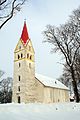 Pärnu-Jaagupi church
 -
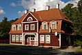 Sindi railway station
 -
 Laupa manor on the Pärnu river
 -
 Monument to Estonian poet Lydia Koidula in Pärnu
 -
 Pärnu mud baths and spa
 -
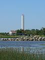 Liu lighthouse in Audru Parish
 -
 Riisa bog in Soomaa National Park
 -
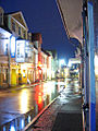 Downtown Pärnu at night
 -
 Häädemeeste church
 -
 Pärnu beach promenade
 -
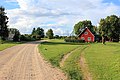 Country road on the island of Kihnu
 -
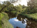 Sauga river


References
- ^ a b "Population by sex, ethnic nationality and County, 1 January". stat.ee. Statistics Estonia. 1 January 2009. Retrieved 2009-10-18.
- ^ a b c "Elanike demograafiline jaotus maakonniti". Kohaliku omavalitsuse portaal. Retrieved 2 April 2018.
External links
- Pärnu County Official website
- Pärnu County Government (in Estonian)
- Town of Pärnu Official website
| Urban municipalities | ||
|---|---|---|
| Rural municipalities | ||
58°25′N 24°35′E / 58.417°N 24.583°E